lidarDetect
Syntax
Description
pointCloulds = lidarDetect(plat,time)monostaticLidarSensor
object mounted on the ego platform, plat.
pointCloulds = lidarDetect(plat,time,includeSelf)plat, on which the sensors are mounted. Specify
includeSelf as true or false.
[
also returns the configurations of the sensors, pointClouds,configs] = lidarDetect(___)configs, at the current
simulation time. You can use these output arguments with any of the previous input
syntaxes.
[
also returns pointClouds,configs, clusters] = lidarDetect(___)clusters, the cluster labels for each point in the point
cloud.
Examples
Generate Lidar Detection for Platform
Create a tracking scenario.
sc = trackingScenario;
rng(2020)% for repeatable results
Add an ego platform to the tracking scenario.
ego = platform(sc);
Add a target platform to the tracking scenario.
target = platform(sc);
Define a simple waypoint trajectory for the target.
traj = waypointTrajectory("Waypoints",[1 1 1; 2 2 2],"TimeOfArrival",[0,1]);
target.Trajectory = traj;
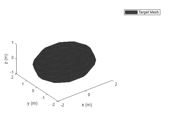
Define a sphere mesh for the target.
target.Mesh = extendedObjectMesh("Sphere");
target.Dimensions = struct("Length",4,"Width",3,"Height",2,"OriginOffset",[0 0 0]);
Show the mesh of the target.
figure()
show(target.Mesh);
legend("Target Mesh")
xlabel('x (m)'); ylabel('y (m)'); zlabel('z (m)');
Create two lidar sensors with different range accuracy. Mount them on the ego platform.
sensor1 = monostaticLidarSensor(1,"RangeAccuracy",0.01);
sensor2 = monostaticLidarSensor(2,"RangeAccuracy",0.1);
ego.Sensors = {sensor1;sensor2};
Generate detections from the two lidar sensor using lidarDetect.
[pointClouds,configs,clusters] = lidarDetect(ego,0);
Visualize the results.
cloud1 = pointClouds{1};
cloud2 = pointClouds{2};
figure()
plot3(cloud1(:,1),cloud1(:,2),cloud1(:,3),'bo')
hold on
plot3(cloud2(:,1),cloud2(:,2),cloud2(:,3),'go')
legend('Sensor1','Sensor2')
xlabel('x (m)'); ylabel('y (m)'); zlabel('z (m)')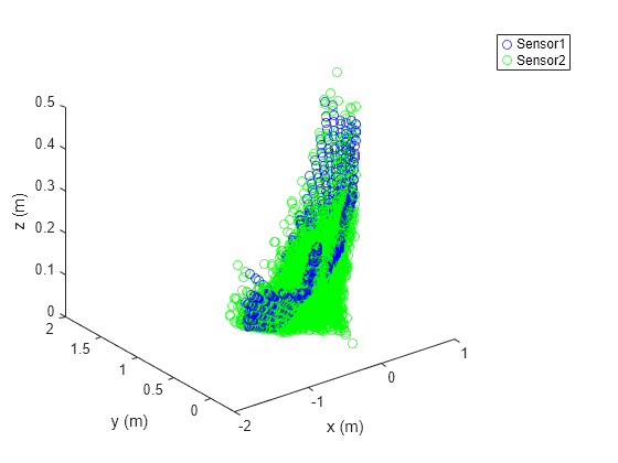
Input Arguments
Output Arguments
Version History
Introduced in R2020b
See Also
Select a Web Site
Choose a web site to get translated content where available and see local events and offers. Based on your location, we recommend that you select: United States.
You can also select a web site from the following list
Americas
- América Latina (Español)
- Canada (English)
- United States (English)
Europe
- Belgium (English)
- Denmark (English)
- Deutschland (Deutsch)
- España (Español)
- Finland (English)
- France (Français)
- Ireland (English)
- Italia (Italiano)
- Luxembourg (English)
- Netherlands (English)
- Norway (English)
- Österreich (Deutsch)
- Portugal (English)
- Sweden (English)
- Switzerland
- United Kingdom (English)
Asia Pacific
- Australia (English)
- India (English)
- New Zealand (English)
- 中国
- 日本Japanese (日本語)
- 한국Korean (한국어)