mapcrop
Crop planar map raster
Description
[
crops the planar map raster B,RB] = mapcrop(A,RA,xlimits,ylimits)A, which uses the raster reference
RA, and returns the cropped raster B and raster
reference RB. The returned raster is cropped to limits in world
coordinates close to those specified by xlimits and
ylimits.
To clip vector data represented by a point, line, or polygon shape in planar
coordinates, use the mapclip function
instead.
Examples
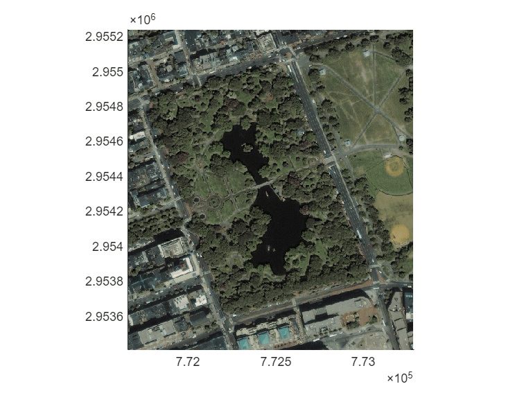
Crop a projected raster image and display the cropped image.
First, import a projected raster image of Boston and a map cells reference object. Then, crop the image to the limits specified by xlimits and ylimits.
[A,RA] = readgeoraster("boston.tif");
xlimits = [771660  773290];
ylimits = [2953410 2955240];
[B,RB] = mapcrop(A,RA,xlimits,ylimits);
Display the cropped image.
mapshow(B,RB)
Input Arguments
Output Arguments
Alternative Functionality
To crop a raster in geographic coordinates, use the
geocropfunction.To create a raster with limits that match
xlimitsandylimits, resample the raster by using themapresamplefunction.
Version History
Introduced in R2020a