extractFrame
Syntax
Description
Add-On Required: This feature requires the Scenario Builder for Automated Driving Toolbox add-on.
[
extracts the next available point cloud ptCloudExtracted,tform] = extractFrame(pcExtractor)ptCloudExtracted from the input
point cloud extractor object pcExtractor. The syntax also returns a 3D
rigid geometric transformation object, tform, which you can use to
transform the extracted point cloud frames from the local coordinate system to the point
cloud map coordinate system.
[
extracts and returns the point cloud ptCloudExtracted,tform] = extractFrame(pcExtractor,frameIndex)ptCloudExtracted for the specified
index frameIndex of the input point cloud extractor object
pcExtractor.
Note: This feature also requires the Lidar Toolbox™.
Examples
Load recorded point cloud data into the workspace.
ptCloud = pcread("USGS_LPC_CA_NoCAL_3DEP_Supp_Funding_2018_D18_w2276n1958_Cropped_geoReferenced.pcd");Display the point cloud object.
pcshow(ptCloud)
Specify the xyz-coordinates of waypoints to create a trajectory. The trajectory coordinates must be within the spatial range of the loaded point cloud data.
egoTraj = [-122.8437 12.1113 39.8113;
            -21.3297 32.1351 33.9599;
             80.4809 49.1138 32.9193];
Specify timestamps for the waypoints of the trajectory.
timestamps = (1:3)';
Create a trajectory object by using the specified xyz-coordinates and timestamps.
traj = recordedSensorData("trajectory",timestamps,egoTraj);Plot the trajectory object.
plot(traj,HeadingStep=1,ShowHeading=true)

Create an ego point cloud extractor object using the point cloud and trajectory information.
pcExtractor = egoPointCloudExtractor(ptCloud,traj)
pcExtractor =
  egoPointCloudExtractor with properties:

              Height: 1.6000
            MaxRange: 120
    SensorParameters: []
          PointCloud: [1×1 pointCloud]
          Trajectory: [1×1 scenariobuilder.Trajectory]
      NumPointClouds: 3
Extract and display point cloud frames from the ego point cloud extractor object until it has no new frames to extract.
figure
frame = 0;
while(hasFrame(pcExtractor))
    pcFrame = extractFrame(pcExtractor);
    frame = frame + 1;
    subplot(1,3,frame)
    pcshow(pcFrame)
end

Reset the ego point cloud extractor object.
reset(pcExtractor)
Load recorded point cloud data into the workspace.
ptCloud = pcread("USGS_LPC_CA_NoCAL_3DEP_Supp_Funding_2018_D18_w2276n1958_Cropped_geoReferenced.pcd");Specify the xyz-coordinates of waypoints to create a trajectory. The trajectory coordinates must be within the spatial range of the loaded point cloud data.
egoTraj = [-122.8437 12.1113 39.8113;
            -21.3297 32.1351 33.9599;
             80.4809 49.1138 32.9193];
Specify timestamps for the waypoints of the trajectory.
timestamps = (1:3)';
Create a trajectory object by using the specified xyz-coordinates and timestamps.
traj = recordedSensorData("trajectory",timestamps,egoTraj);Create an ego point cloud extractor object using the point cloud and trajectory information.
pcExtractor = egoPointCloudExtractor(ptCloud,traj);
Initialize an empty point cloud array and a 3D rigid geometric transformation object.
pcFrameArray = pointCloud(zeros(0,pcExtractor.NumPointClouds));
tformArray = rigidtform3d;
Extract all point cloud frames and 3D rigid geometric transformation objects from the ego point cloud extractor object.
for i = 1:pcExtractor.NumPointClouds
   [pcFrameArray(i),tformArray(i)] = extractFrame(pcExtractor,i);
end
Extracted point cloud frames are in the vehicle coordinate system. Transform the extracted point cloud frames from the vehicle coordinate system to the point cloud map coordinate system by using the pcalign function. The function aligns the extracted array of point clouds into one point cloud using the extracted geometric transformation information.
pcAligned = pcalign(pcFrameArray,tformArray);
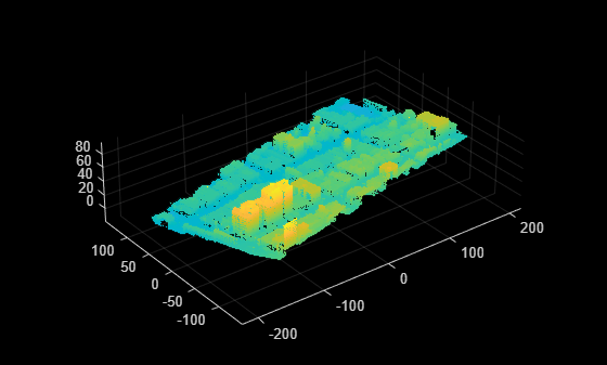
Display the transformed point cloud.
pcshow(pcAligned)
![]()
Input Arguments
Output Arguments
Version History
Introduced in R2025a